Wednesday 26 November saw Opposition party members Arena Williams and Rachel Brooking (Labour), alongside Lan…
Looking Into the Past
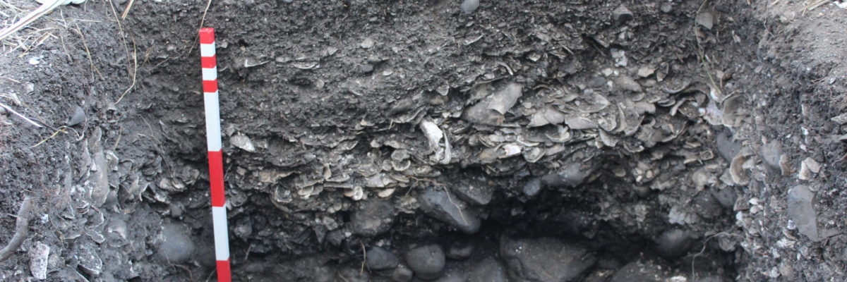
On the main beach of Ōtata Island there is a Māori midden about 50 metres in length.
In March 2020 Auckland Museum archaeologists carried out a small excavation on the midden in partnership with the Neureuter family and Ngāi Tai ki Tāmaki. The goal of the excavation was to record valuable information from the important site before it is lost to erosion.
In January 2018, huge swells in the Hauraki Gulf caused widespread damage to coastal areas around Tāmaki Makaurau and the Coromandel. On the main beach of Ōtata, up to 5 metres of the already exposed midden was further eroded and washed away. The damage to the Ōtata midden highlights the vulnerability of coastal heritage sites to increasing storm events, coastal erosion and acceleration of sea level rise expected in the future. In this case, it was not feasible to build a sea wall to protect the midden from further erosion, leaving archaeological investigation as the best way to preserve the important information held within it.
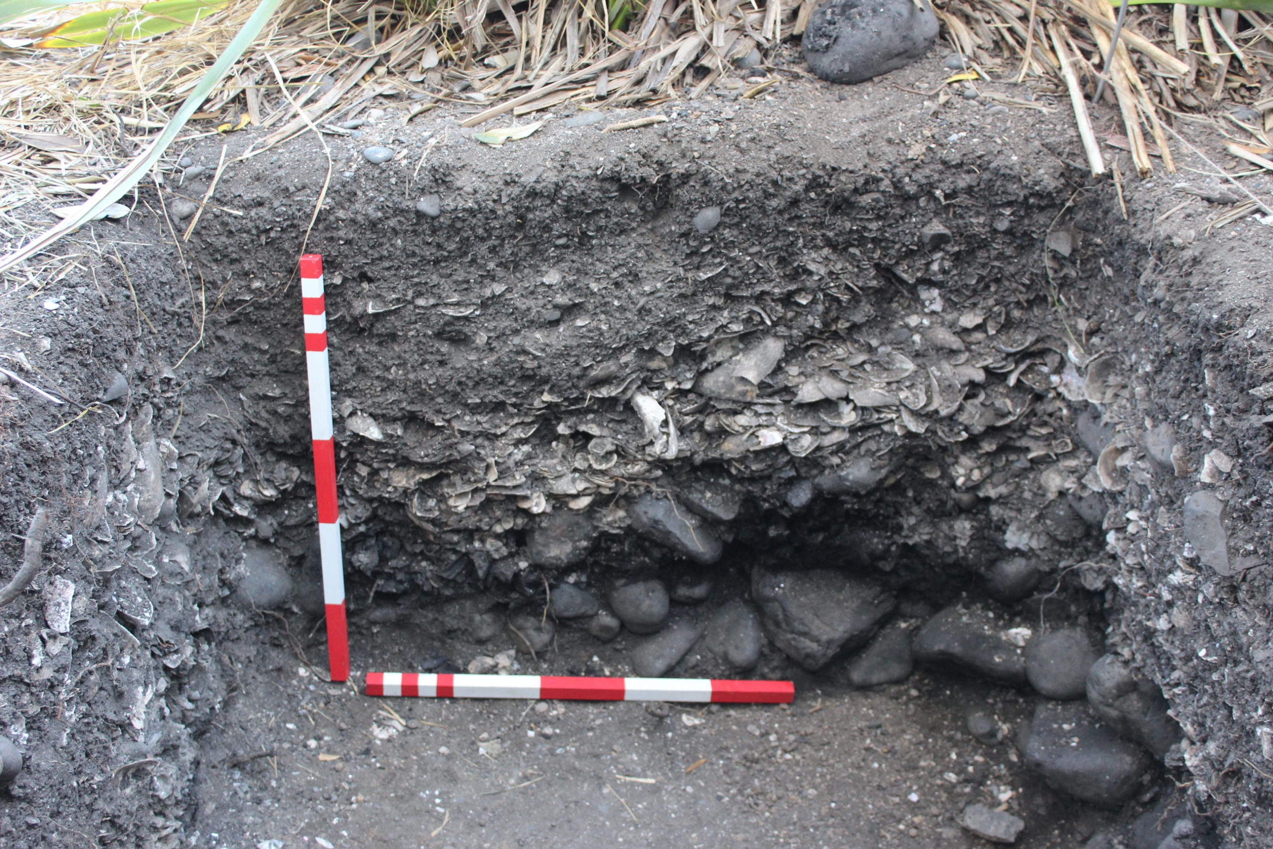
A midden is a rubbish heap of domestic waste and an irreplaceable source of information about how people lived in the past and about the natural environment at the time. The Ōtata midden exposure indicates at least two stages of occupation, characterised by dark layers of soil containing shellfish, bird and fish remains, stone flakes, stone and charcoal-filled fire-scoops and several post-holes indicating where shelters may have been.
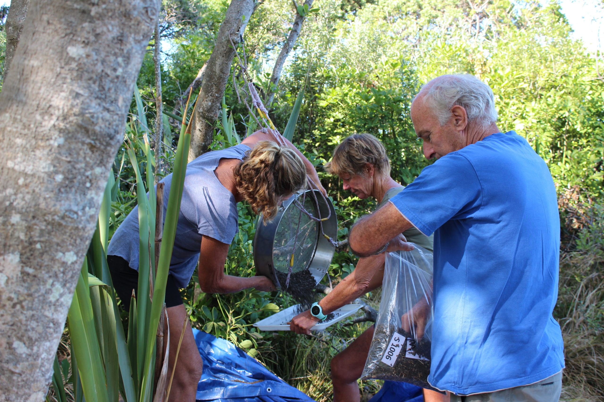
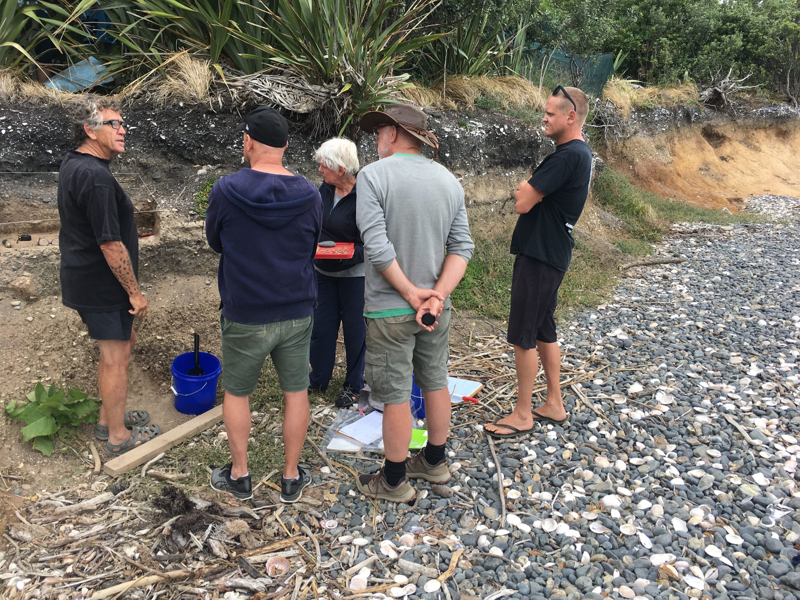
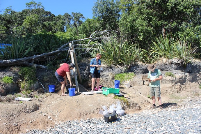
The archaeologists, along with the Neureuter family and representatives from Ngāi Tai, spent a week on Ōtata excavating three 1x1metre squares in the midden. Each layer was carefully removed using a trowel. The contents of each square were sieved to remove excess soil while retaining the shell, bone and charcoal which was then bagged for analysis.
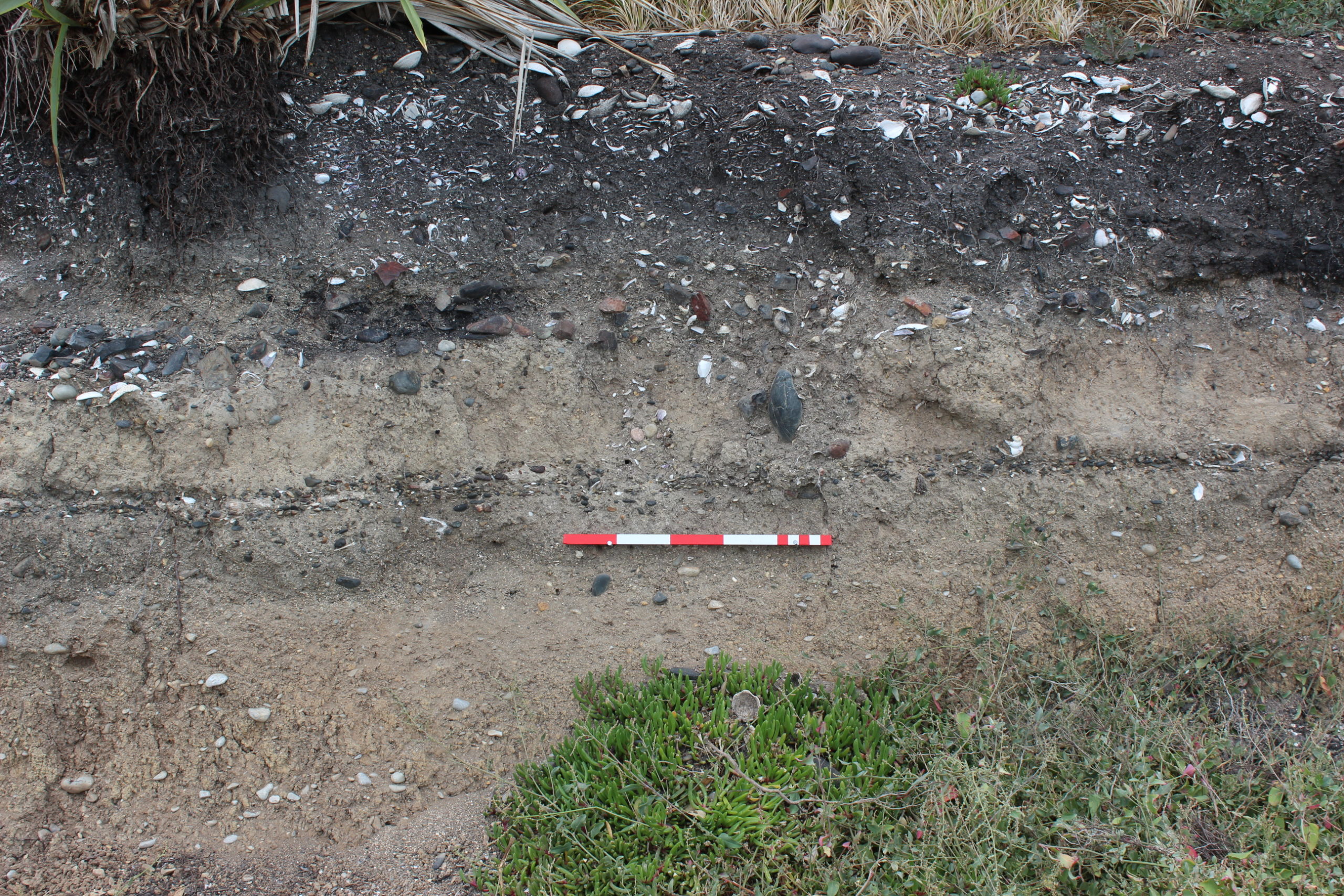
A very large hāngi was uncovered during the excavation: it contained burnt shell, a dense charcoal layer and large stones measuring over 20cm. The actual size of the hāngi is unknown because it extended into the walls of the excavation square. A dense concentration of unburnt mussel shells sealed in the hāngi contents. A second exciting discovery was the presence of Māori occupation beneath a layer of volcanic ash from the eruption of Rangitoto, making the site the second in the Auckland region with such evidence. The other site is the Sunde site located on nearby Motutapu Island. The Rangitoto eruption is dated to around the start of the 15th century and acts as a marker layer, so any occupation layer below the tephra (ash) must predate it. Other sites in Tāmaki Makaurau predate the eruption but the tephra drifted to the north east to cover Motutapu, Rakino and Ōtata sealing in the early occupation layer.
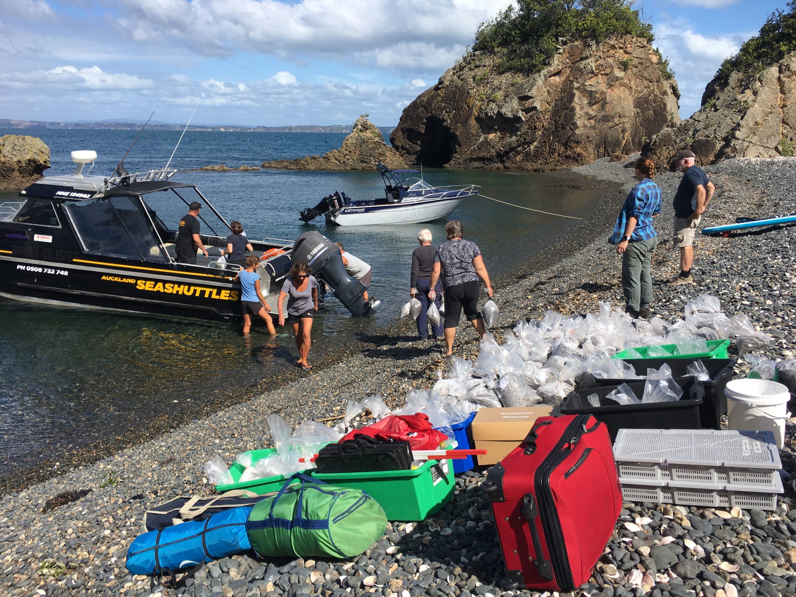
Working on a remote island comes with a few logistical nightmares. Fine weather conditions and calm seas are key along with precision planning as you can’t just pop to the shops. No power meant a generator had to be taken to charge essential laptops, camera batteries and phones! A total of 500kg of shell, bone and charcoal was collected during the excavation to be taken back to Auckland Museum for analysis, requiring multiple boat trips.
Analysis of the material collected will involve identifying all the shell, fish and bird species present and the quantities of each. This is a time-consuming process. These findings will help build a comprehensive picture of what Māori ate and what the environment was like hundreds of years ago. This will provide insight into Māori food preferences and the season in which the species were taken. Identification of bones will inform us on what birds were present and if species such as the spotted shag, which is no longer nesting on the island, was previously resident there. In addition, head bones of fish such as snapper can be measured to estimate whether fish length has declined over time. Isotope analysis of shells can reveal environmental changes such as water temperature and sedimentation. Other environmental information can be obtained from charcoal, which can be identified by a specialist, and tell us something about what the vegetation was like in the past. Because there are at least two occupations, radiocarbon dating provides a time dimension.
The partnership with Ngāi Tai ki Tāmaki provides a novel approach where the archaeological evidence is looked at alongside Mātauranga Māori (Māori knowledge), and the evidence gathered serves to support ancestral stories of Māori activity in the Hauraki Gulf over many generations. There is a common goal of gathering valuable information from at-risk archaeological sites and an active response to coastal erosion instead of watching it happen. The results from the excavation also serve as a remarkable baseline for contemporary biodiversity surveys and contribute to understanding the changing environment around the Noises islands and the wider Hauraki Gulf.
Related Posts